 WA9TT Amateur Radio Station
Current Conditions
Band Conditions
NGØE's VHF Propagation Map displays current VHF band openings during the past hour. It uses data gathered by APRS-IS. The map is created using lat/long info, and hops from node to node that data travels. By correlating hops with the position at each end of the hop, distances can be inferred.
Type WA9TT-10 in the search box (lower left hand corner) to see my iGate coverage during the past hour. Adjust zoom, as necessary, to more clearly see the black coverage perimeter.
Planetary Kp Index

2 Meter Propagation
Hepburn Map
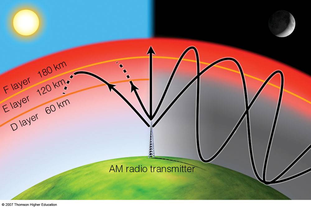
HF & Propagation
Understanding Solar Flux, A and K indexes is very important for serious HF operation. With pre-knowledge of the conditions, one can determine if a band will be open, and whether DX contacts may be successful.
- Higher sun spot number indicate increased ionizing radiation from the sun. This enhances the ionosphere's ability to refract HF signals. The sun spot number can vary from 0 to over 200 during the peak of the 11-year solar cycle.
- Solar Flux is a measurement of radio signals from the sun. This index is taken daily at 2800 Mhz. Increased radio noise from the sun means more ionizing radiation. This correlates with the sun spot number. Solar flux values range from 60 (no sun spots) to 300.
- The A index is the level of geomagnetic activity. Geomagnetic activity includes anything that upsets the magnetic field that surrounds the earth, such as solar dust (which comes off of the sun during a solar flare) and other charged space dust.
The A index can range from 0 to 400, but it is rare to see it go above 75. More often you will see A index readings between 4 and 50. Values below 10 are very desirable for HF communications.
A lower number indicates that the geomagnetic field is less disturbed. The higher the A index climbs, the "louder" the noise on the bands becomes. Quite bands, therefore, correspond to low A indexes. Quiet bands allow weaker signals to come through more clearly, as there is less noise to interfere.
- The K index is similar to the A index, but reflects conditions from the previous three hours. It's values range only from 0 to 9. Lower numbers mean a quieter Ionosphere.